Hello! I am currently a junior at the
University of Colorado Boulder,
working towards both my BS and MS in Computer Science with a minor in Computer Engineering
and a certificate in Geographic Information Science and Computational Science.
I am interested in low-level programming, computer architecture, cartography, and weather dynamics.
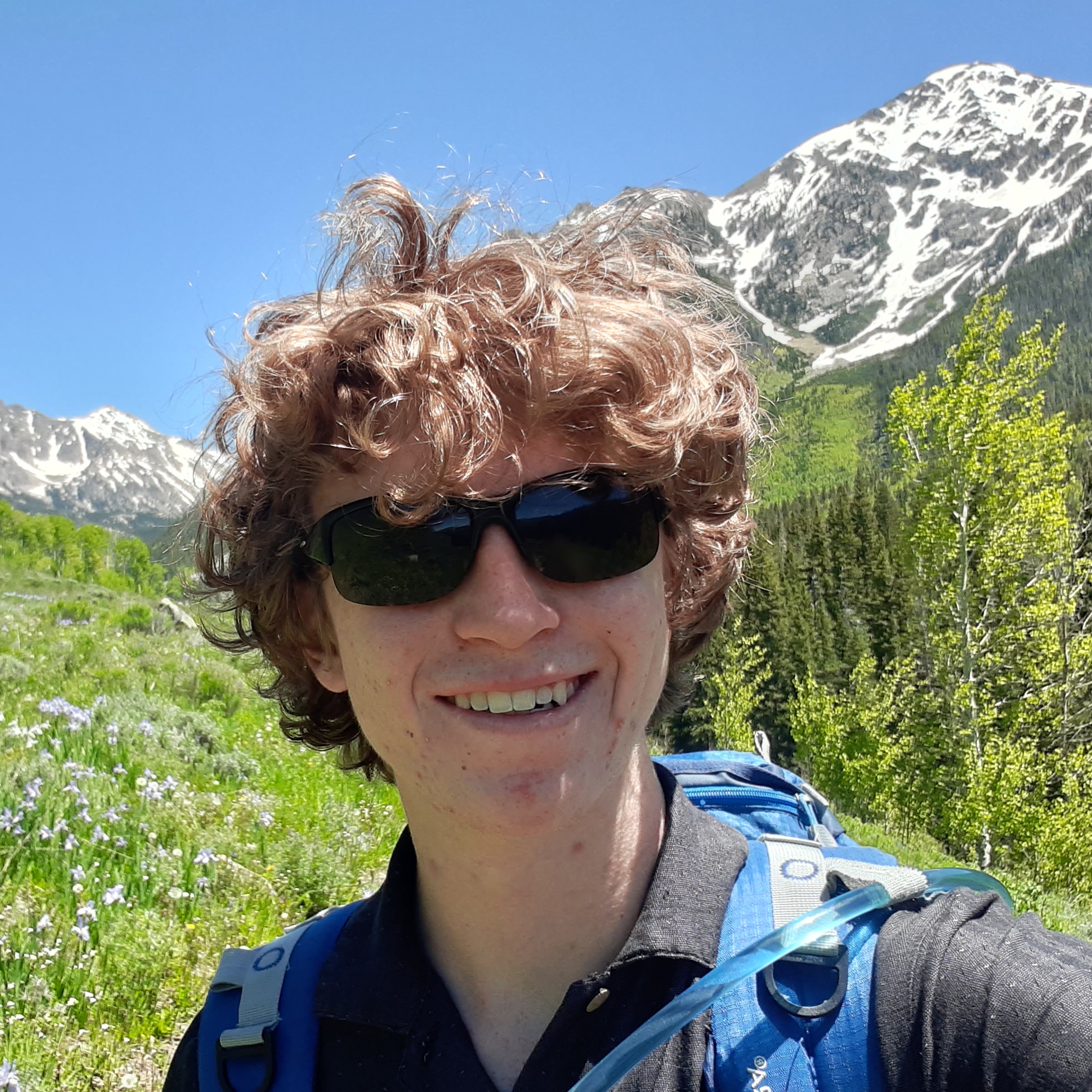
Solo backpacking in the Gore Range, CO. 2023
I grew up in the Colorado Rockies and love everything about being in the mountains, and have a small obsession with the arctic.
You can learn more about some of my adventures in the interests section below.
A fun fact about me is that I have citizenship in three countries: United States, Canada, and Ireland.
Projects
Click on a project to learn more!
Hover Text
Personal Website
Description of project... this is a lengthy description of my project which included a lot of work.
Click to learn more about it!
LanguagesLibrariesSkills
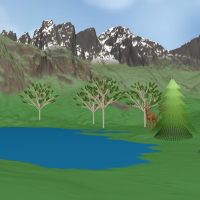
OpenGL Mountain Scene
Description of project...
COpenGLArcGIS ProGDAL
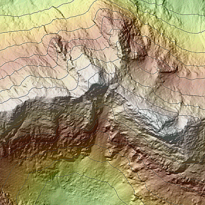
DEM Accuracy Improvement Proposal
An original academic proposal for improving the resolution and accuracy of digital elevation models using remote sensing techniques and machine learning algorithms.
Machine LearningLiDAR Data Manipulation
Hover Text
Clientscript Libraries
Description of project... this is a lengthy description of my project which included a lot of work.
Click to learn more about it!
Snow Hydrology Research Intern | Institute of Arctic and Alpine Research
January 2025 -- Present
Collect snow stratigraphy data from multiple high elevation remote sites. This data consists of snow density, snow water equivalent, grain size/type, depth, and temperature.
Data is published through the Niwot Ridge LTER web portal.
Present poster on my work at the Hydrologic Sciences Research Symposium.
Computer Science Department Assistant | University of Colorado Boulder
August 2024 -- Present
Manage the Computer Science Education Lab, which includes scheduling room bookings and providing resources to students.
Assist the CS Front Office by answering phone calls, sorting mail, loaning out resources, and more.
Forestry and Landscaping | Coal Creek Canyon, CO
June 2020 - August 2024
Started a yard work service within the local mountain community, interfacing with a large
number of clients and managing my teams schedule and tasks.
Primarily built rock walls and cleared trees to mitigate wildfire risk and control erosion.
Provided volunteer services to community members in need.
Back-end Developer | Blueprint Boulder
August 2022 - June 2023
Developed an online portal for the local non-profit organization Lafayette Empowerment Center.
Created a database system for managing their students, programs, and donations.
Details about the OpenGL Mountain Scene project go here...
In March 2024, I wrote an original academic research proposal which aims to increase the resolution and
accuracy of digital elevation models through the combination of LiDAR sensing drones and a machine
learning algorithm. The proposal focuses on the methods, limitations, and cost of this approach specifically
within Colorado, however the concept can be applied globally.
Currently, the highest resolution publicly available digital elevation models in Colorado are the 1-meter
DEMs provided by the United States Geologic Survey 3D Elevation Program. The USGS DEMs have a few limitations
in that acquiring higher resolution data is difficult and time-consuming with modern aviation and satellite
technology. Additionally, since the data is gathered from far above the ground, steep terrain such as cliffs
and gullies is often inaccurate and distorted. My method aims to improve both the resolution and the
accuracy on steep terrain by collecting a small amount of high resolution data where possible, and
extrapolating the results across state-wide terrain.
The basic idea is to use the drones to get high resolution DEMs over a series of quadrants throughout
Colorado that exhibit different terrain characteristics. From each unique area, half of the DEMs will
be used as training data and the other half will be used to verify the effectiveness of the algorithm.
The machine learning algorithm in question will accept a USGS 1-meter DEM as input, along with information
about the location and characteristics of the quadrant, and output a high resolution DEM while still
maintaining the true elevation data points provided by USGS.
Details about this project go here...
For this project, I made something that can be seen. It looks like this:
I even wrote some code in main.c that made that happen. You can copy it if you'd like. Here it is:
// Example Program
#include <stdio.h>

int main() {
    printf("Hello, World!\n");
    return 0;
}
This is a very long code snippet, too long to show all of it. Fortunately you can scroll or show more.
// Long Code Snippet
void super_long() {
    printf("This is a very long line of code. I probably shouldn't have a line this long but just in case I do I want to see what happens. In this case it should just go off the edge and allow me to scroll instead of text wrapping.\n");
    printf("Hello, World!\n");
    printf("Hello, World!\n");
    printf("Hello, World!\n");
    printf("Hello, World!\n");
    printf("Hello, World!\n");
    printf("Hello, World!\n");
    printf("Hello, World!\n");
    printf("Hello, World!\n");
    printf("Hello, World!\n");
    printf("Hello, World!\n");
    printf("Hello, World!\n");
}
I do need this to be even longer though, and I also want to test out the text wrapping to see what
happens if I just keep typing and typing and typing until the text goes off the page. Hopefully this should
be enough.
I do need this to be even longer though
I do need this to be even longer though
I do need this to be even longer though
I do need this to be even longer though
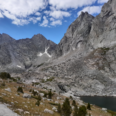
I even wrote a paper, and it looks like this:
Map:
look at all the things I have to say about my hikes!